City Hall Property Details
Contributed by Lana Ivanoff, a Resident Researcher for this site.
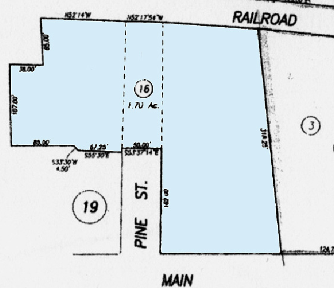
"I recently went to City Hall and obtained a copy of the parcel map, which has been discussed in closed session, concerning the sale of City Hall. That parcel number is referred on the agendas as APN 009-016, 1480 Main Street. Noting that there was no such number on the map that matched that description, I went to the County Assessor’s Office seeking clarification. Parcel 009-016 includes the Firehouse property, the part of Pine closed off by the building of the Firehouse and the property which houses the City Hall building (from Main to Railroad).
There are no measurements across the front of the City Hall property or across the entire back portion of the property (including the measurements of Lyman Park along Railroad). When I inquired about this at the Assessor’s Office, I was told that it is City owned property, that no taxes are paid on the property and therefore no measurements are needed. I was frustrated by this answer because it makes defining the property boundaries difficult."
Lyman Park is parcel #3 only (see map below). Parcel #009-016 is being discussed in closed session meetings. The part above parcel #19 that is adjacent to #16 (Firehouse property) is the Pine Street easement (dotted lines) including the long parcel (without a number) next to it. I asked the mapper, Paul, in the Napa County Planning Department about the process involved and if the City is taking some of Lyman Park, considering there are no measurements on much of this property? He said that when they survey the land for sale, they can sell whatever they want, using their new measurements. So we really have no idea what they are looking at selling....only what we can guess they are considering."
Zoning Map of City Hall Area
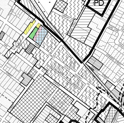
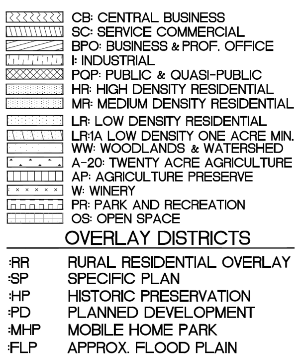
In this partial Zoning Map, Lyman Park is identified as zoned Park & Recreation -- note the section on Main St. that is represented by small boxes. Notice there is a line (pink vs blue) that is in the middle. Does the split mean that part of Lyman Park is within the City Hall property parameters for zoning purposes? A portion of Pine St., through the Fire Department area, is a "public easement" and, according to many who have public easements on their own property, cannot be sold. In the diagram below, the City Hall parcel is blue. Admin.
If anyone has further information about this area and can offer more clarity, please let us know.
Here is the language from the California General Plan Guidelines and State Code relating to the disposal or acquisition of public property:
GENERAL PLAN GUIDELINES
PAGE 104 of CHAPTER SIX, CAPITAL IMPROVEMENTS/PUBLIC FACILITIES
Capital improvements and public facilities are subjects
that are listed under the land use and circulation
elements in §65302. In addition, §65401 requires that
proposed public works projects be reviewed annually
for conformity with the general plan. Further, §65402
prohibits acquisition or disposal of public property without a finding from the planning commission of conformity with the general plan.
§65402 Restrictions on acquisition and disposal of
real property.
(a) If a general plan or part thereof has been adopted,
no real property shall be acquired by dedication or otherwise for street, square, park or other public purposes, and no real property shall be disposed of, no street shallbe vacated or abandoned, and no public building or structure shall be constructed or authorized, if the adopted general plan or part thereof applies thereto, until the location, purpose and extent of such acquisition or disposition, such street vacation or abandonment, or such public building or structure have been submitted to and reported upon by the planning agency as to conformity with said adopted general plan or part thereof. The planning agency shall render its report as to conformity with said adopted general plan or part thereof within forty (40) days after the matter was submittedto it, or such longer period of time as may be designated by the legislative body.
Parcel Map of City Hall Area